Manufacturer of high-quality measuring tools
laser distance meter
Basic functions of laser distance meters
In addition to the simple measurement of distances, the laser distance meters have a variety of useful and advantageous functions. Thanks to an intuitive design and convenient menu navigation, the devices remain easy to use. From simple area and volume calculations to indirect height measurements and inclination measurements, the distance meters are almost all-rounders.
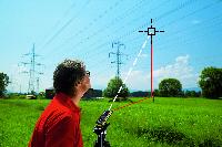
Indirekte Höhenmessung
Foto: Leica Geosystems |
|
![]()
|
|
![]()
|
Areas of application for laser distance meters
The laser distance meters can be used both indoors and outdoors, although special devices with a digital pointfinder are preferred for outdoor use. This allows measuring points to be aimed at reliably and precisely, even at great distances and in strong sunlight. Whether for measuring, checking or calibrating, the range of applications for these devices is extremely diverse.
Distanzmessung im Innenbereich
|
|
Distanzmessung im Außenbereich mit Zielsucher
Foto: Leica Geosystems
|
|
![]()
|
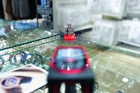
Accessories and aids for laser rangefinders
For optimum reflection of the laser dot or in the absence of reference points, so-called target plates are used. For laser distance meters with a tilt sensor or digital pointfinder, we recommend using them with a suitable tripod. Alternatively, adapters are also available for these models, which can be used to attach the laser distance meters to tripods or plumb bobs.
Zieltafel GZM3
Foto: Leica Geosystems |
|
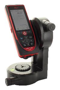
Entfernungsmesser auf einem Adapter mit Feintrieb
|
|
![]()
|
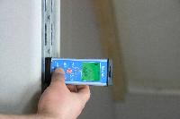
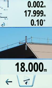
Laser distance meter with interface for data transmission
We would like to highlight the models with a data interface via Bluetooth. With these devices, the measurement results can be easily and conveniently transferred to smartphones, tablets and laptops for further processing. With the corresponding free apps, for example, pre-prepared sketches or even photos can be dimensioned on the spot and then sent immediately by email. The new generation of distance meters has a USB interface for transferring photos, screenshots and, of course, measurement results. A few distance meters even have WLAN, which makes it possible to transfer measurement data in DXF format directly to a corresponding CAD program.
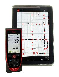
Datenübertragung via Bluetooth direkt an das Smartphone
|
|
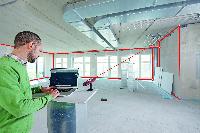
Direktes Messen in das CAD-Programm über WLAN
Foto: Leica Geosystems
|
|
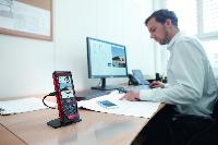
Übertragung von Fotos und Messdaten über USB-Schnittstelle
Foto: Leica Geosystems |